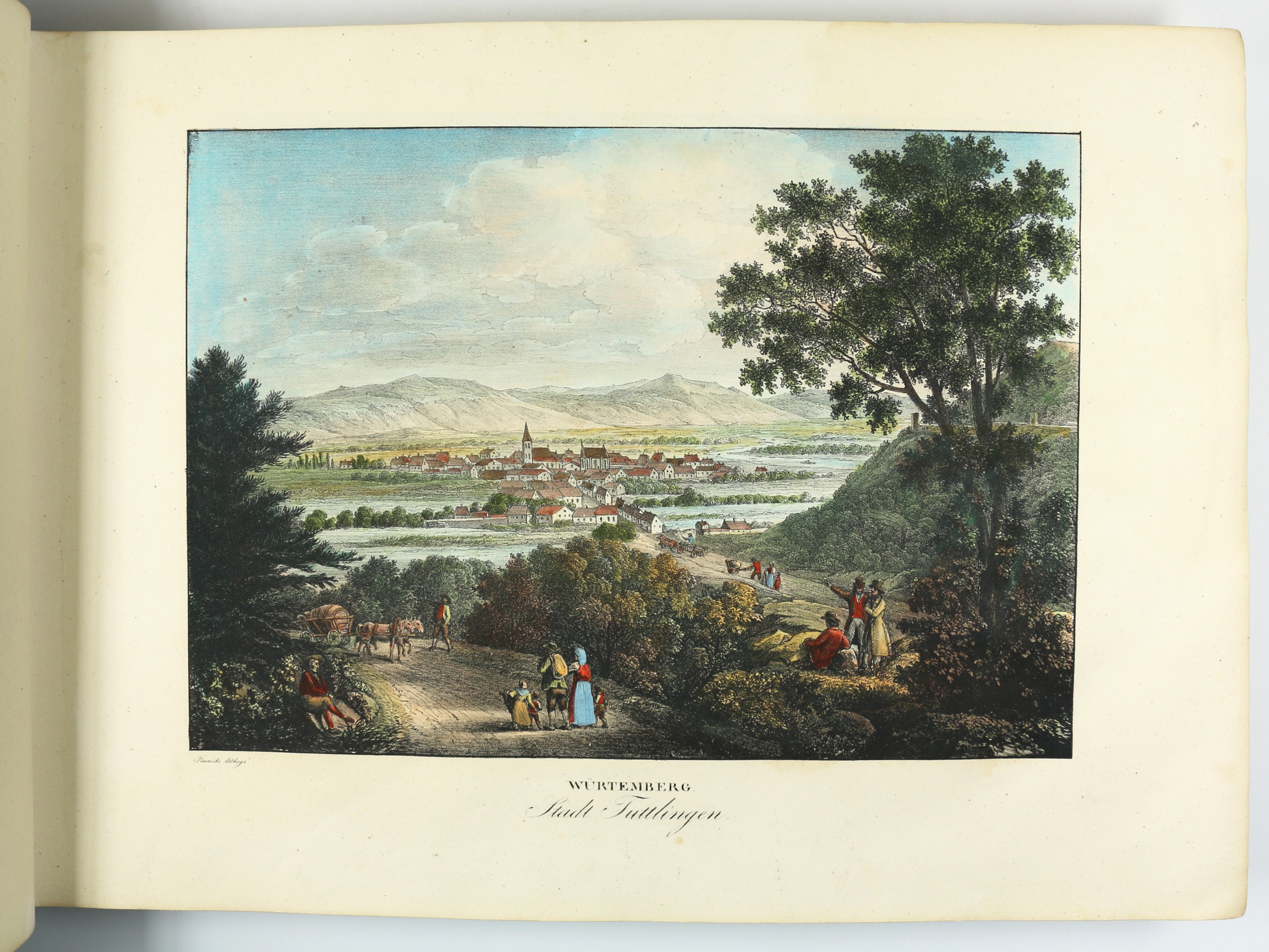
Zwey hundert vier und sechzig Donau-Ansichten nach dem Laufe des Donaustromes …Vienna, 1826.
A splendid set of views, probably the finest record ever published of the course of the Danube from its source to its outlet into the Black Sea. This is the only copy in contemporary colour known in the trade and in auction records of the last decades.
The Danube played a vital role in the settlement and political evolution of central and southeastern Europe. Its banks, lined with cities, castles and fortresses, formed the boundary between great empires, and its waters served as a vital commercial highway between nations. In the 21st century the river has continued its role as an important trade artery and is now a vital part of the New Silk Road project.
Contains views of Baden (nos. 1-3 & 5), Württemberg (nos. 4 & 6-11), Bavaria (nos. 12-48), Austria (nos. 49-123, 125), Hungary (126-157), and of the Balkan states and Turkey (nos. 158-264). Includes the complete text as well as the four-part, cloth-backed map. Complete copies are of the utmost rarity, and copies coloured throughout must be considered almost unobtainable. The auction records of the last 50 years list no more than six complete copies, of which this present one was the only one in original colour (Hartung & Hartung, Munich, sale 99 [2000], lot 787).